We also use cookies.

We use cookies to give you the best possible experience on our website, to provide social media functions and to analyze access to our website.


Three red darts embedded in the bullseye of a blue-and-white target, with a bright sky and sun glare behind.

Success Stories

Successful customers and successful projects

Success stories from our customers

Find out more about our users, their specific requirements and the customized solutions we have developed for them.

Quality assurance for digital zoning plans

Aerial view of Salzburg, Austria: a river winds through the city, crossing bridges among dense pastel rooftops and church spires; a hilltop fortress overlooks the town, with mountains rising in the distance.

Faced with the challenge of digital spatial planning, processes in the state of Salzburg were optimized and automated using FME.

Austrian Post uses FME for the deployment of GIP data

A bright yellow delivery van occupies a pedestrian crosswalk in a city square, with modern buildings and a white church with twin towers in the background as pedestrians walk nearby.

FME Form as an integration tool  is used by the postal service to automatically create an ArcGIS-compatible data set from the data in the graph integration platform.

Digital twin: voestalpine relies on FME technology

Digital twin: voestalpine relies on FME technology

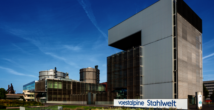
From data conglomerate to digital 3D campus: How voestalpine AG in Linz is bringing the digital twin to life with the help of FME.

The important use of FME at Médecins Sans Frontières

The important work of FME with Médecins Sans Frontières

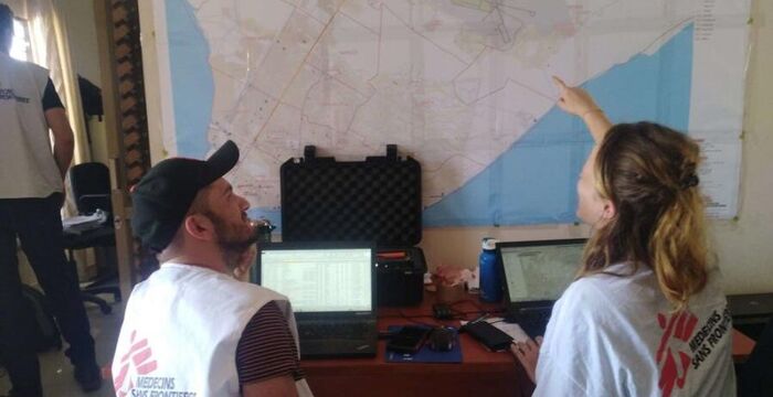
The integration of geodata with FME also plays an important role in the documentation of disasters at the private aid organisation Doctors Without Borders.

Abu Dhabi: Efficient agricultural controls

Aerial view of a farm with neat rows of green crops, palm-lined roads, and irrigation canals stretching toward distant hills.

ADAFSA, the Agriculture and Food Safety Authority in Abu Dhabi, uses FME to harmonize a central database.

Automation of online ordering and checking processes for geodata

An ornate clock tower perched on a tree-covered hill, featuring two clock faces and a dark, multi-tiered roof. Surrounding terraces and flower beds line a winding walkway with orange banners, offering a view over a city and distant hills under a bright blue sky.

The city surveying department of the city of Graz uses FME to automatically process processes behind digital forms.

Hannover Airpoirt: A hub for flights and data

FME as central data hub at Hanover Airport

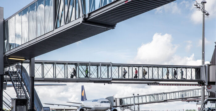
FME acts as the central data hub at Hanover-Langenhagen Airport.

Automatic preparation of GIP data for Austrian Federal Railways

Automatic preparation of GIP data for ÖBB

axmann created two FME-supported solutions for the Austrian Federal Railways (ÖBB) that automatically prepare open.

Vorarlberg Energy Networks relies on axmann solution

A hiker with a blue backpack walks along a gravel trail beside a bright turquoise alpine lake, with rugged gray mountains rising beyond and a blue sky overhead.

Vorarlberg Energy Networks validate supplied natural inventory and water data using the geodata checking service.

Geoinformation in the UNESCO World Heritage of Bamberg

Panoramic view of a historic European town with dense rows of orange-red tiled roofs along a river. Colorful houses line the waterfront, and a large Gothic-style building with tall spires dominates the distant skyline.

FME for data manipulation evolved from a one-time tool into a central data hub in the public administration of the city of Bamberg.

Optimisation of air traffic information management

A detailed topographic map with purple boundary lines and a highlighted route across a mountainous region, featuring labeled places and elevation contours.

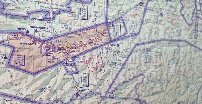
Optimisation of air traffic information management at Austro Control with the help of FME Form and FME Flow.

Austrian Federal Railways use Open Data

A modern pink-and-teal high-speed passenger train labeled "Railjet" speeds along a gravel railway, under overhead electric lines with a tall power pole in view, seen from a low side angle.

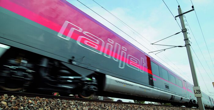
FME-supported solutions for the Austrian Federal Railways (ÖBB) that automatically prepare open data for tasks in the organization’s GIS.

Data validation at the Austrian Federal State of Burgenland

A modern, multi-story government building with glass balconies and flagpoles displaying the EU flag and two red banners, set beside a green lawn and trees.

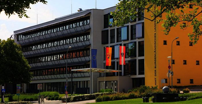
Data validation at the Austrian Federal State of Burgenland for conceptual masterplan data.

Daily updated cadastral data with FME support

A detailed cadastral map of a town showing dense housing along a network of roads, with a river running through the area and surrounding fields and forested hills.

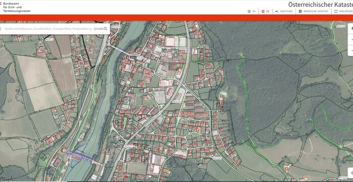
The Austrian Federal Office for Calibration and Measurement (BEV) has recently made daily updated cadastral data available. axmann supported the service with FME processing tools.

FME in “border operations” at the Austrian Federal Forests

An aerial view of a dense forest with varied green trees; a narrow winding path runs through the canopy.

The Austrian Federal Forests document boundary stones with photos and integrate them into their database system using FME.

Geodata shop for Austrian VERBUND as a central data hub

Front view of a blue shopping cart in a supermarket aisle, seen from cart level. Shelves stocked with groceries line both sides toward a bright, blurred distance.

A geodata shop at VERBUND provides geodata for further processing. The basis for this solution is axmann geodata broker.

These companies rely on axmann's services:

Logo Asfinag
A red three-dimensional capital letter A with a black superscript 1 at the top-right.
Logo BEV
Logo Wiener Netze
Blue rectangular Airbus logo with the white word "AIRBUS" on the left and smaller white text "DEFENCE AND" on the right.
Logo for the Air Navigation Service of the Czech Republic.
Logo of Vorarlberg Netz, an energy company. Blue bold wordmark "vorarlberg netz" with a red and yellow wedge/icon to the left, and the tagline "Energie für Generationen."

Team

Several hands from a diverse group are stacked together, representing teamwork, unity, and collaboration.

As a specialist in data management, we rely on experienced and trained employees.

Jobs

A hand holds a magnifying glass over a blue background, revealing a bullseye target with a red arrow hitting its center, symbolizing targeting a specific audience.

Bring your talent and know-how to our team and become part of our success story.

About us

Overhead view of a large, diverse group of people gathered on a gray stone courtyard in a manicured garden, forming a circular cluster and looking up at the camera, with green lawn, trimmed hedges, statues, and a metal framework in the background.

axmann geoinformation is based in Vienna and is highly specialized in the field of geodata and geoinformation.


axmann Kontakt
Contact us
Modecenterstrasse 22/Top D59-D61
1030 Vienna, Austria
Tel +43 1 203 91 47
E-mail office@axmann.at
Nach oben