Quality assurance for digital zoning plans

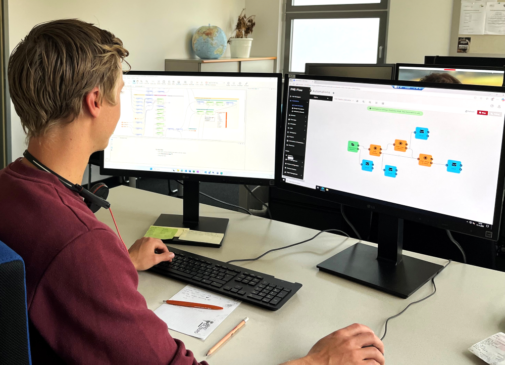 Further checks of the data can be added by Lennert Hammer, an employee in the Software Development Department, in the FME Workbench itself.
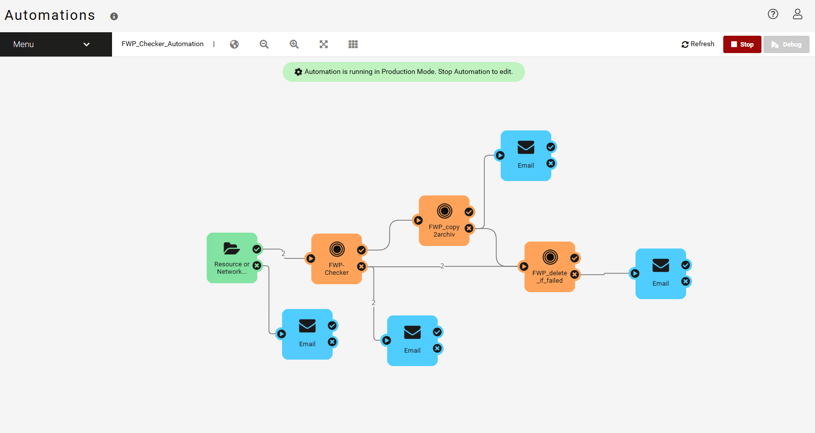 The graphic shows the workflow for automated checking of zoning plan data.
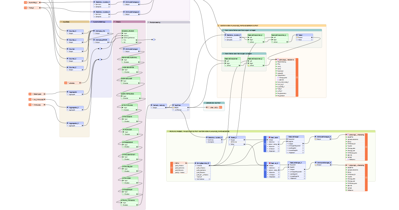 The Workbench in FME shows the many steps that are necessary in the background for data verification.
With the challenge of digital spatial planning, processes in the state of Salzburg were optimized and automated using FME.
In the state of Salzburg, zoning plans were digitized manually for a long time—a time-consuming and error-prone process. With the amendment of the Spatial Planning Act in 2009 and the Representation Ordinance, digital submission via the “ROGServe” internet application became mandatory. Since then, plans must be submitted in both PDF and GIS data formats in accordance with a defined data interface.
Quality assurance
The main challenge was how to ensure the quality of the data submitted by local planners before it was transferred to the state's geodataset. The submitted zoning plan data is therefore checked directly when the data is uploaded.
Janine Spörl from the Software Development Department in the state of Salzburg describes the initial situation as follows: “Data verification ensures that only positively verified data is transferred, and the uniform structure facilitates the maintenance and updating of the geodataset – measurable in terms of greater timeliness, completeness, and consistency.”
Automated data verification with FME
In collaboration with axmann geoinformation, the state of Salzburg developed an automated verification routine based on the descriptive data interface. This routine checks the zoning plans in terms of technical content, attributes, and topology. The results are output as an error log and GIS file—a crucial step in ensuring data quality.
Until now, the online verification service axmann geodata checker has been used as the initial verification tool, and more recently FME Form and FME Flow have been used for the creation, maintenance, and automated execution of the verification workspaces. In the future, FME Form and FME Flow will take over all verification tasks and completely replace axmann geodata checker.
This means that checks will be carried out “on-premise” using the state of Salzburg's own FME infrastructure. They can be expanded flexibly. “Additional checks can be easily integrated into the workbench; we can expand them or add to them ourselves,” says colleague Lennert Hammer, explaining the structure of the workflow.
Efficiency, quality, and future-proofing
The solution brings noticeable advantages to everyday spatial planning: it enables automated data transfer to the GIS database, efficient and resource-saving processes, and high data quality through structured checks.
The test routine is currently being transferred from the axmann server to the State of Salzburg's own FME Flow. This will integrate the solution even more closely into the existing infrastructure and link it to other applications.
A reliable partner for digital geodata processes
The State of Salzburg has given its collaboration with axmann a thoroughly positive assessment: “axmann geoinformation stands out for its flexibility, high reliability, and quick response times. Clear communication and a solution-oriented approach in particular have made our collaboration noticeably easier.”
The project impressively demonstrates how digitization and automation can increase quality and efficiency in public administration—and how strong partnerships lead to success.
Would you also like to automate processes?
We would be happy to advise you on individual processes. As a system integrator, we not only distribute the FME software, we also customize it and integrate it into your IT landscape as a complete solution.
Contact us.
Photos and screenshots: © Spatial Planning Department, Office of the Salzburg Provincial Government, Image 1: © Adobestock
“The digital zoning plan interface is a major milestone in the digitization of spatial planning in the state of Salzburg: Quality-assured data verification ensures that only positively verified data is transferred, and the uniform structure facilitates maintenance and updating of the geodataset—measurable in terms of greater timeliness, completeness, and consistency.”